Mount Whitney marks the southern end and grand finale of the John Muir Trail. Photo by Matt Johanson
By Matt Johanson
Keep your footing on the steep and slippery granite. Fight for breath in the thin air. Navigate a tight passage packed with hikers on the exposed mountainside. Above all, grip the cables like cold death, because that’s what awaits those who falter.
Half Dome has more than a dozen climbs leading atop Yosemite National Park’s most popular peak. Even the easiest of these terrifies the uninitiated. That would be the cable route on the mountain’s east face, a popular detour on the John Muir Trail.
When I first attempted the ascent in 1994, I had just started rock climbing and possessed some confidence in high places. Still, the angle of the terrain reached 60 degrees, making my heart race.
Hikers pull themselves up, and lower themselves down, using steel lines bolted to the rock. But these provide no help to those who lose their grip even for an instant. Since the cables went up in 1919, ten people using them have fallen to their deaths. Countless more have frozen on the perilous slope, crying or screaming, too fearful to continue up or down.
Climbers pull themselves up the steel cables on Half Dome’s steep east face. Photo by Matt Johanson
A young woman in our party suffered that ordeal, forcing a retreat. So, we came better equipped for the next effort. This time, our team wore climbing harnesses and brought slings and carabiners to secure ourselves to the cables. What a difference those safety measures made.
Reaching the 8,846-foot summit still wasn’t easy, but all four of us managed to muscle our way up. All in our early 20s, none of us had ever climbed a mountain like that before. The exhilaration, pride and bird’s eye view of sensational Yosemite Valley were unforgettable.
That ascent highlighted my first experience on the John Muir Trail, a life-changing journey that attracts thousands of trekkers per year. The storied path leads 211 miles from Yosemite Valley south to Mount Whitney, passing hot springs and glaciers, beside 14,000-foot peaks and through canyons 5,000 feet deep.
The trail’s name honors a Scottish immigrant and shepherd who became the most influential naturalist of the 19th century. John Muir reached California in 1868 and spent years exploring the Sierra Nevada. Among his exploits is the first documented ascent of Yosemite’s 10,915-foot Cathedral Peak, a favorite of mine.
In an age when loggers downed giant sequoias and carved “tunnel trees” for photo opportunities and road tolls, Muir penned articles that helped convince Congress to create both Yosemite and Sequoia national parks in 1890. Today, the two parks mark the north and south ends of Muir’s namesake trail.
Selden Pass provides one of the most rewarding views on the whole John Muir Trail. Photo by Matt Johanson
“No temple made with hands can compare with Yosemite,” Muir wrote.
A similar sense of awe struck me when I first set foot on the John Muir Trail in the summer of 1994. Like most Yosemite newbies, I was completely overwhelmed by the park’s towering rock walls, rushing rivers and rounded domes. When I walked beneath Vernal Fall, the waterfall’s tidal waves of mist soaked me to the bone; this hike needs a rain jacket even in summer. The JMT had plenty more to teach me.
Bears appear to Yosemite tourists all the time yet eluded me during my first years of Sierra sojourns. When the first wild bear I ever saw up close approached, excitement got the better of me, and I shot pictures like mad.
My fellow forest-dweller didn’t like it and let me know with a snarl and sudden step in my direction. The bluff charge nearly made my heart leap out of my chest. I got the message and backed off, a bit wiser than before.
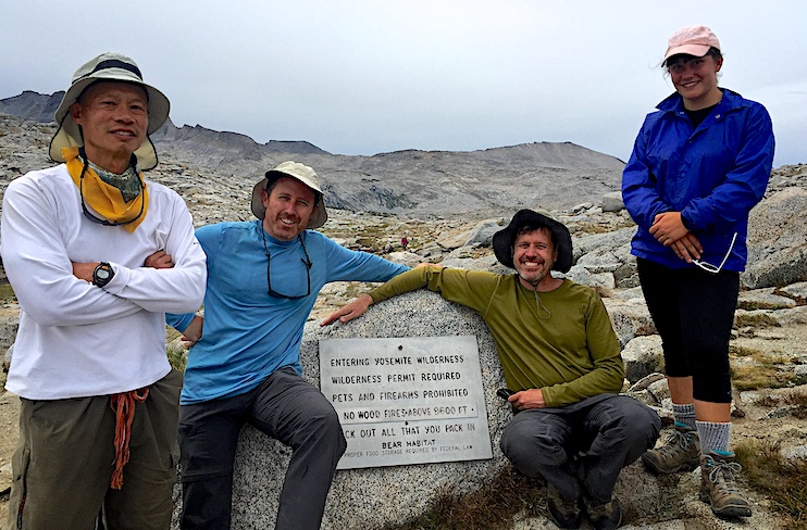
Rangers constantly caution Sierra hikers about bears, and rightly so. Backpackers present a serious threat to the black and brown bears residing there. Those that taste human food can become aggressive, forcing officials to relocate or even kill them. That’s why hikers are required to store their food in bear-proof canisters.
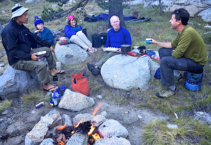
Hikers enjoy a campfire and dinner in Yosemite. Photo by Dan Johanson
But no bear-proof container will stop a bear from wandering through a camp in search of food. One furry face did so in Lyell Canyon as two friends and I cooked dinner on a JMT hike in 1998. No bear-stalking for me this time. Instead, we banged our pots and pans together to scare him off. Not at all frightened, the bear nonetheless trudged away. I took pictures from a respectful distance.
Heading south, the trail runs through 11,066-ft. high Donohue Pass, at the border of Yosemite and Ansel Adams Wilderness. Unlike Half Dome, this challenge lies directly on the path and there’s no avoiding it. Just to make things interesting, my group tackled it in the winter of 2005.
As we cross-country skied down Lyell Canyon, heavy and sticky snow made progress slow and difficult. They don’t call it “Sierra cement” for nothing. We brought wax, but not enough, forcing us to drag pounds of snow beneath our skis for miles, slowing us like an anchor.
When we finally approached Donohue Pass, a steep and formidable ice slope stood in our way. To climb it, we would have to risk a wild slide down the incline that would drop a skier several hundred feet, and not gently.
The slope was steep, but every alternative was steeper, so there was no choice but to attempt it. Under heavy packs, we kicked our skis hard with every step to gain traction on the hard ice. When my turn came, I leaned into the incline and wished we’d brought ice axes and rope for safety.
Relief flooded me when I emerged from danger and reached the pass. An exciting view of nearby Mount Lyell and Banner Peak greeted our four-man group. To our amazement, so did hundreds of butterflies, the first fauna we had seen in several days.
Clearing Donohue Pass, the trail’s first major obstacle, is cause for celebration. Photo by Dan Johanson
After snapping a few victory shots, we pointed our skis downhill for a change. I don’t mind climbing hills and hard work. But after averaging one mile an hour for two days, I was ready for some fun, like gliding effortlessly down a three-mile descent toward Thousand Island Lake. With the trek’s crux behind us, the joyful run lifted the whole team’s spirits and reminded me why we had come. When you have to earn everything you get, the highs feel higher.
I picked up the trail from about the same spot with a new group later that year. This time I joined my cousin Andy, his 15-year-old daughter Anna and two other friends. I also brought Gracie, my German shepherd. Dogs are not permitted in national park wilderness areas, but are legal in national forests, including about 70 miles of the John Muir Trail’s midsection.
Our trek south through the Inyo and Sierra national forests featured fantastic vistas from Silver and Selden passes, refreshing swims in beautiful mountain lakes, and a decadent soaking in Blayney Meadow Hot Spring.
An early-season hike after a big winter meant high water in the river crossings. That made me worry about Gracie, who was a great hiker and swimmer but not as tall as our human team members. Once I spent quite a while seeking a safe route for her to cross a fast-running stream. I looked up to find her staring at me from the other side, happily wagging her tail. While I was wasting time, she had trotted across rocks and logs to the far shore. I wasn’t the only one learning new skills.
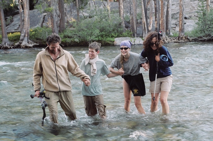
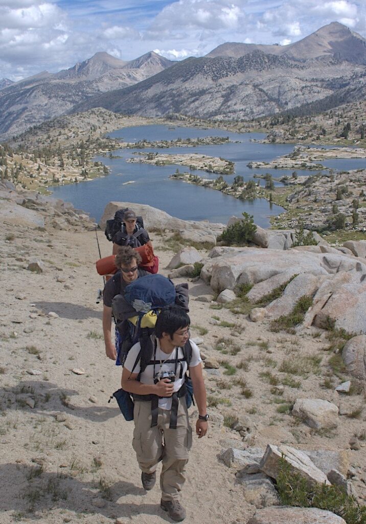
Hikers carefully cross the South Fork of the San Joaquin River. Photo by Matt Johanson
After a week on the trail, we reached the border of Kings Canyon, which meant Gracie and I had to split from the rest of the group. We hiked east over Piute Pass to reach the town of Bishop. A different experience awaited Andy and company as they continued south.
To save a few days, Andy chose not to detour off trail for his final food drop. The result was a faster trip, but a hungry crew that had to ration even their lemon drops for a week.
During their last days, there was nothing left but a handful of powdered milk, a cruel ration for hikers who averaged 15 hard miles per day.
They had discovered a can’t-miss weight loss plan that’s eluded the tabloids: “Walk all day and don’t eat anything.” Andy lost 19 pounds. Anna, slender and athletic, somehow lost 12 pounds. The team hustled to their finish line and a high-calorie victory feast in town.
Running out of food never pleases anyone, but neither does an overly heavy backpack. All hikers struggle to balance comfort and light pack weight; you can’t have both.
“Everybody up there looks skinny after a while,” Andy observed.
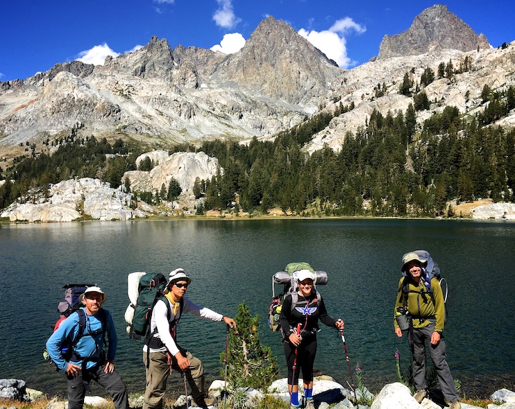
Kings Canyon demanded return visits, so this summer I returned to where the John Muir Trail leads through lush meadows, into deep glacier-carved canyons and through high granite peaks. The national park boasts stark and rugged beauty similar to Yosemite. But this part of the trail stands in the middle of a 165-mile long roadless wilderness. No one can reach it without a long walk, giving it a remote character quite unlike Yosemite.
By the time I discovered the area, I’d learned to avoid the obvious mistakes: travel light, but carry adequate food, prepare properly for winter, and above all, leave the bears alone! I had also developed an interest in mountaineering, so I keep an eye out for achievable summits.
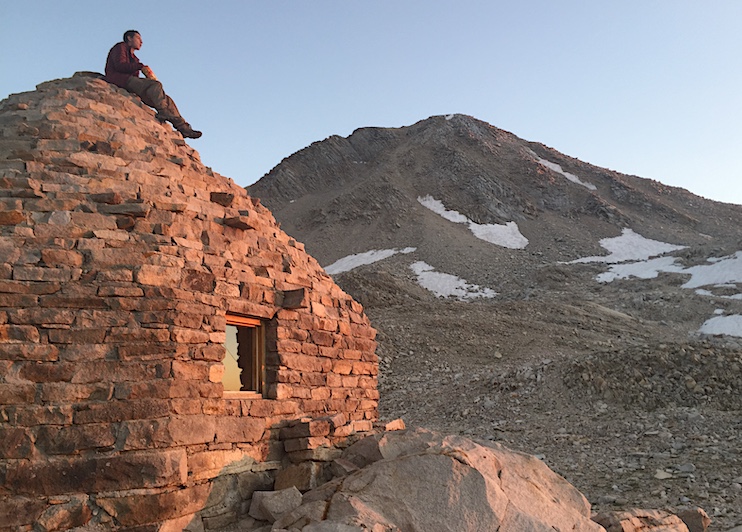
A hiker contemplates Mount Solomons from the top of the Muir Hut. Photo by Matt Johanson
Mount Solomons caught my eye. The 13,034-foot summit stands 20 miles from the nearest road, but less than a mile (and 1,079 vertical feet) from the JMT at Muir Pass. So, three months ago two companions and I spent several hours scrambling up boulders to the crest of the mountain. The climb was tiring but not steep enough to worry us and looking at the breathtaking High Sierra from above never gets old.
Later I looked up the mountain’s namesake, explorer Theodore Solomons, who spent years mapping this area in the 1890s. Later, he proposed a trail between Yosemite and Mount Whitney. The idea caught on and construction began in 1915 when California committed $10,000 to the project. Laborers finished the path now named after Muir in 1938.
It didn’t take long for the new route to deliver benefits. Photographer Ansel Adams immediately hiked the JMT and published a beautiful book of scenic photographs. That helped convince Congress to establish Kings Canyon National Park in 1940.
These history lessons made me better appreciate this area, the trail and those who made it. Kings Canyon marks the most difficult part of the JMT, requiring hikers to clear four passes each around 12,000 feet high within 50 miles. That means climbing around 5,000 feet per day.
But how much harder was the construction of those paths on miles of steep and rocky slopes at high elevation? The 23-year effort involved backbreaking labor dozens of miles from the nearest road. Even hiking in and out with the necessary tools would break most people today. Lucky for us, American men during the Great Depression of the 1930s were so desperate for income that they gladly joined the federal Civilian Conservation Corps. It tasked them to create paths around steep cliffs studded with granite escarpments. Their salary was $1 a day.
Hikers enjoy the view in Ansel Adams Wilderness. Photo by Dan Johanson
Earlier, we had considered climbing additional peaks such as Fin Dome or Mount Tyndall. But after our weary group cleared the exhausting Mather, Pinchot, and Glen passes on consecutive days, enthusiasm for additional objectives disappeared. “Out of the question,” we agreed.
Sequoia National Park exhilarated me on my first visit. My Uncle Ted, cousins Peter and Maggie and I hiked a 50-mile segment in 1997. I had never done a prolonged hike in the High Sierra before. Jagged peaks and rare foxtail pines combined for a spectacular landscape, but we underestimated the trip’s difficulty. Slow progress on our first two days made our last two days murderous. Mountain miles are more about the mountains than the miles, I learned. Our trek exhausted and thrilled us.
One can see John Muir’s name on many geographic features. There’s the John Muir Trail, John Muir Wilderness, Mount Muir, Muir Woods, and John Muir Memorial Shelter, which stands atop Muir Pass. Why not honor Susan Thew as well? Women mountaineers were nearly nonexistent when she hiked hundreds of miles in the High Sierra with a camera in 1923. Her photos and zealous advocacy helped convince Congress to expand Sequoia National Park in 1926.
Hiking in darkness at well above 12,000 feet is cold, but by this point, everyone had endured worse conditions. Plenty can go wrong on a High Sierra hike. Besides the aforementioned hunger and fatigue, hikers contend with altitude sickness and injuries. Route-finding errors are common. Bloodthirsty mosquitoes swarm everyone with a pulse. Thunderstorms may deliver rain, hail, snow, and even lightning in every month of the year.
I confronted all of these challenges over the years and learned from each of them. A 2018 hike presented another danger that was new to me: wildfire. A large and fast-moving blaze struck Yosemite right after my group started our hike during what became California’s deadliest fire season. Smoke fouled the air on our first days as we trudged past smoldering debris. But thankfully, the fire did us no real harm.
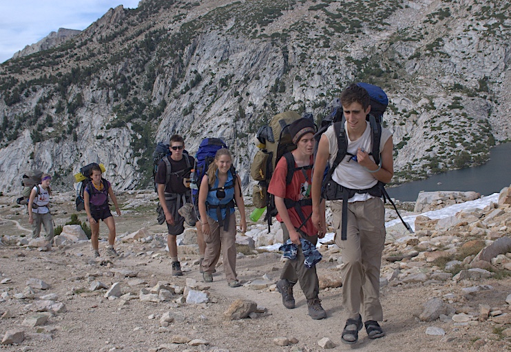
A group of young hikers ascends a pass in Sierra National Forest. Photo by Matt Johanson
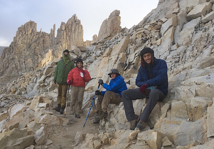
On that 2018 hike, I accompanied four teenagers who were summiting Mount Whitney for the first time. We started well before sunrise, ascending slowly beneath flickering headlamps under a black and starry sky. Climbing switchbacks to the highest summit in the lower 48 states warmed us, and as the sun began to rise, we could see countless peaks and valleys around us. As the teens stomped their feet to keep blood flowing in their limbs, they laughed and hugged in a moment they will remember forever. Sharing this experience with new hikers felt great.
From Crabtree Meadow to the summit of Mount Whitney, then descending to the Whitney Portal Trailhead totals 20 tough miles to the hike’s grand finale. The John Muir Trail officially ends on Mt. Whitney, but unless you can fly, there are ten more miles to the nearest road. This final stretch descends along 99 notorious switchbacks. But at least it’s downhill.
The kids sped ahead to gorge themselves at the trailhead cafe, but I took my time to enjoy the last miles. Already, I was beginning to miss trail life and thinking about the next time I would climb to the summit of a mountain.
I’ve stood upon the summit of Mount Whitney five times with my brother Dan, my Uncle Ted, and cousins Peter, Maggie, Andy and Zach. These precious memories stand out in years about which I remember little else. I wouldn’t trade them for anything. The hardships we overcame to enjoy these moments only make them sweeter.
California native Matt Johanson enjoys hiking, climbing and writing about the outdoors. His books include Yosemite Adventures: 50 Spectacular Hikes, Climbs, and Winter Treks and California Summits: A Guide to the 50 Best Accessible Peak Experiences in the Golden State. His first story for the East-West News Service described climbing Yosemite’s El Capitan.